Cutler Park Reservation (Needham, MA)

Date Of Visit: June 2, 2019

Location: 84 Kendrick St., Needham, MA

Hours: open daily dawn to dusk

Cost: Free

Parking: There is free parking for about 50 cars in the main lot and parking may be available at nearby lots.

Universally Accessible: Yes

Dog Friendly: Yes

Park size/trail difficulty: 600 acres, easy to slightly moderate

Highlights: wildlife, hiking, pond, kayaking, cycling and running trails

Summary: This 600-acre park protects the largest freshwater marsh on the middle Charles River. This park is a great spot for birdwatchers, and it also features eskers, or riverbeds formed inside a glacier; drumlins, long hills formed by glaciers; and Kendrick pond.

Website: Cutler Park Reservation

Hiking Trails Map: Cutler Park Reservation Trail Map

IMG_9434

Named for the State legislator, Leslie B. Cutler, who helped the Department of Conservation and Recreation of Massachusetts acquire the land, Cutler Park has some hidden historical significance many visitors may not be aware of.

Soil was removed from what is now known as Kendrick Pond to fill in the area now known as the Back Bay of Boston.  And, if you look closely near the Kendrick St entrance of the park you can still see some of the old tracks of the railroad that was used to transport the soil to Boston.

Although I’m not sure, this tunnel may have been used to transport some of the soil, rocks or logs from the park.  But, now it is used to support the railroad that runs adjacent to the park.

1231234

12345

Mist was settling upon Kenrick Pond as I arrived at the park.  It created the perfect backdrop for photos of the landscape and swans at Kendrick Pond (aka Cutler Pond).

Cutler Park has a diverse assortment of wildlife and birds.  Although I did not see them during my visit, deer and fox are said to be present there. I did see a few other critters, though.

It was spring during my visit so there were a lot of babies at the park.  I got to see some goslings and cygnets with their parents.

You’ll hear a variety of birds tweeting (offline).


IMG_9906

or getting a quick bite

IMG_0010

or just chilling in the abundant trees at Cutler Park.

IMG_9781

The trails at Cutler Park are mainly easy with a few slight inclines.  The signature part of the trails is the boardwalk along the marshy area.

IMG_9771

But, there’s something about the tree lined dirt paths that gives the park a “country” feel despite the fact it is located deep within the suburbs.

IMG_9897-2

Cutler Park is popular with kayakers, runners, cyclists and people in some unusual water vessels.

What truly makes the park a hidden jewel are the beautiful views.

The wide paths and pond make Cutler Park a dog friendly park.

The way Casey, a 10 year old Yellow Lab, fetched could give any of  the Sox outfielders a run for their money.

IMG_0089

IMG_0082

Say goodbye to Teddy, a one and a half year old Golden Doodle mix, from Cutler Park!

IMG_9807


Hidden History – Moswetuset Hummock (Quincy, MA)

Date Of Visit: March 39, 2019

Location: Moswetuset Hummock, 440 East Squantum St, Quincy, MA

Hours: open daily, dawn to dusk

Cost: Free

Parking: Free parking is available for about a dozen vehicles:

Universally Accessible: Because of the dirt and rocky surface and a few slight inclines it is not universally accessible

Dog Friendly: Yes

Highlights: views of Quincy and the surrounding area, short trail, historic importance

Summary: A small, often overlooked park in Quincy, MA, has a special historical significance to Massachusetts

IMG_5884

Sometimes hidden history is in the wide open.  Such is the case with the small park located along the Wollaston Beach and Quincy Bay area.

The .4 mile loop (yes it is a very short trail) is easy.  Along the short trail you’ll see pretty views of the neighboring Wollaston Beach and Squantum (another name with a historical connection to the area).

While the trail at Moswetuset is short and easy, if you walk down the somewhat steep side of the trail, you can get some pretty views of Boston and the Quincy area.  These photos were taken from the rocky area off the main trail during twilight in March.

Moswetuset, which means “shaped like an arrowhead”, is often overlooked for the more popular Wollaston Beach which is located around the corner from Moswetuset.  Yet, the fact that it is overlooked gives it a special charm.   It also has an interesting historical background.

Moswetuset is said to have been the seat of the ruling Massachusetts Chief Chickatawbut.  It is also the place where Plymouth colony commander Myles Standish and his guide Tisquantum (Squanto) met with Chief Chicktawbut in 1621.

Named after the native tribe of Moswetuset, the name of this area would later become known as Massachusetts.

IMG_5888

As the sign below states, Chief Chickawawbut agreed to a treaty with then Governor Winthrop which neither side broke.  And, of course, there is a Dunkin’ Donuts across the street which you may see in the background.  It is Massachusetts after all.

IMG_5958

From Wollaston Beach the area looks simply like a wooded area without much to see.

Yet, hidden within that cluster of trees lies a true hidden treasure with a hidden history.


Daffodil Festival (Naumkeag, Stockbridge, MA)

Date Of Visit: May 10, 2019

Location: Naumkeag, 5 Prospect Hill Rd, Stockbridge, MA

Cost: Trustees Nonmembers: $20
Seniors and students 15 and up: $15
Trustees Members: FREE
Children 6 – 14: $5
Children under 6: FREE

Hours (the Daffodil Festival ended May 12,)

April 14 – May 27
Open weekends only, with tours 10AM – 5PM (last tour starts at 3:30PM)

May 28 – October 8
Open daily with tours 10AM – 5PM (last tour starts at 3:30PM) including holidays

Parking: Free parking for about 20 cars is available.  There may be a lot for overflow parking as well.

Trails: Easy

Handicapped Accessible: No.

  • Naumkeag is not ADA-compliant, due to the age of the site. There are many stairs, a steep hillside, uneven footing, etc.

Dog Friendly: Dogs are not allowed in the gardens.

Summary: The Daffodils Festival is an annual event that has daffodils and other flowers, trees and plants planted along their trails.

IMG_8074

Each year, the Trustees at Naumkeag in Stockbridge, MA bring some color and beauty to the drab rainy early spring season.  Their daffodil celebration begins in April and last until the second week of May.  Just in time for Mother’s Day!

As you begin your visit at the Naumkeag Estate, you will first enter a greenhouse with a diverse collection of flowers and plants.

While daffodils are the main attraction, they aren’t the only flowers showcased at the festival. An assortment of other flowers, such as tulips, complement the daffodils.

The trees at Naumkeag are just as impressive as the flowers even if they didn’t have many buds or leaves on them at that time.

Naumkeag has many events and programs for children.  We saw these butterflies which were part of a children’s scavenger hunt.

IMG_8176

The stairs and trails are well kept.

There are many statues and other decorative items along the trails.

The estate at Naumkeag is much more extensive.  But, unfortunately, the rain prevented us from exploring it more.  I am sure I will make another trip to see more of this beautiful hidden gem!

If you missed the Daffodil Festival, fear not!  The festival is help every year in Mid April to early May.

Spring Bunny Quest (Francis William Bird Park, East Walpole, MA)

Date Of Event: April 27, 2019

Location: Francis William Bird Park, Polley Lane, Walpole, MA

Hours: Open daily from sunrise to sunset

Cost: Free

Parking: There are multiple parking lots located on Polley Lane, Pleasant Street and Rhoades Avenue.

Trail Size/Difficulty: 89 acres (3 miles of walking trails), easy

Handicapped Accessible: Yes

Dog Friendly: Yes

Highlights: wooden cutout bunnies hidden on the trails, trees, play areas, tennis and basketball courts, trees, ponds

Web Site: Francis William Bird Park

Trail Map: Francis William Bird Trail Map

Summary: 6 cutout bunnies were hidden along the various trails at Francis William Bird park

IMG_7658

While bunnies are not uncommon at William Francis Bird Park (more commonly known as “Bird Park”), there were a very different type of bunny there earlier this spring.  To mark the arrival of the spring cotton tail bunnies to the park, Bird Park hid 6 wooden cutout bunnies for visitors to look for.

While there was a map located at the visitor center board near the center of the park showing where the bunnies were located, the Trustees, who operate the park, encouraged visitors to find them on their own.  So, I tried.  I tried for 3 hours.  I was also taking photographs of the wide variety of beautiful trees and other treasures of the park.  I did find 5 of the bunnies on my own.  Then, I gave in and found the last bunny after looking at the map.

The bunnies really weren’t too hard to find.  Even the “hidden bunnies” were in open view, even if they were located next to a rock or tree.

The bunnies also had a small notepad for visitors to write messages.  One popular message written on the notepads can be seen below.

IMG_7593

The park has been a hidden attraction for many years.  In fact, it has existed in one form or another for almost 100 years.  Francis William Park was endowed and created by Charles Sumner Bird, Sr and his wife Anna in 1925.  The park was created in memory of their eldest son, Francis William Bird who died in 1918 at the age of 37.  The Trustees, who operate the park currently, gained ownership of the park in 2002.

Bird Park has so many great features,  The trails are easy to navigate and there are many toys and playthings for children to use in the “tot lot”.  There are also basketball courts and tennis courts.

The main attraction of the park, though, must be the trees.  There are a variety of trees at the park with the names of their particular species.

I wonder what species of tree this is.

IMG_7630

One particular tree at the park stands out among the rest.  A plaque dedicated to Charles Sumner Jr is located at the base of this majestic tree.

IMG_7624

IMG_7622-2

There are many stunning views at the park.

And, of course, what would Bird Park be without birds?

There are lots of benches to sit on and admire the views.  Some of these benches look pretty old!

In addition to an extensive play area, there is a cute little library in the children’s playground.

IMG_7743

The music court, built in 1931, was designed for performers to use to entertain the community.  There are changing rooms and restrooms (which I’m pretty sure are no longer in use) attached to the stage for performers to make costume changes before or during their performances.

Your dog will love the long trails and spacious field at the park.  The appropriately names Achilles, a 10 year old American Eskimo and Cocker Spaniel mix, didn’t let his injury stop him from roaming the park.

IMG_7688

Ruh roh!  It’s like Scooby, a 5 year old American Pitbull mix.  Zoinks!

IMG_7591

Bare Cove Park (Hingham, MA)

Date Of Visit: March 30, 2019

Location: Bare Cove Drive, Hingham, MA

Cost: Free

Hours: Daily, sunrise to sunset

Parking: There are 2 parking lots.  The larger parking lot located at Bare Cove Drive has room for about 100 cars.  There is also a smaller parking lot off Beal St

Trail Size/Difficulty: 484 acres, easy

Handicapped Accessible: Yes, there are paved trails but the side trails may not be accessible to all

Dog Friendly: Yes (see website for rules for taking dogs to the park)

Highlights: wildlife, birds, nature, lake, easy trails, cycling, running, scenic, museum

Website: Bare Cove Park

Map of Park: Bare Cove Park Map

IMG_5580

Once the site of a ammunition depot, Bare Cove Park is now a 484 acre park full of wildlife, scenic views and trails for running, cycling or just walking.

There is a variety of birds and other wildlife at the park.  Foxes, coyotes and even deer have been reportedly seen at the park.  So, do keep this in mind if you do bring your dog.  I didn’t see any aforementioned animals at the park.  But, I did see a diverse group of birds there.

Granted, I did have to go off the beaten paths to view some of these birds, particularly the hawks and kestrel.  But, you should see lots of cardinals, blue jays, sparrows and other smaller birds in your travels, even on the main trails.

The main trails are paved and wise in most parts.  So there is lots of room for cyclists, runners and people walking with their dogs.

IMG_5731

One of the many great things about Bare Cove is that it is beautiful all year.  You might think that it wouldn’t be very pretty during the early spring time.  You’d be wrong!  But, seriously, the natural colors and the trees are majestic.  Even the multi colored ones. Alt If you are looking to see plants and flowers and other colorful views I do recommend visiting in the mid to late spring, summer or, of course, fall.

One of the hidden historical aspects of the park is its military past.  The area was used to produce and distribute munitions and other military devices. Until 1971, military goods were produced here.

In an effort to commemorate the service of the people who worked at these depots, there is a small museum with exhibits, photos, military tools and other gadgets that were made at the depot.

IMG_5774

IMG_4931

There is also a viewing area to watch videos and DVDs about the history of the depot and how Weymouth and Hingham, MA contributed to the war effort.

There are two monuments outside of the museum.

One of the monuments is dedicated to all of the workers who helped the war efforts.

IMG_5772

The next memorial is dedicated to the workers who lost their lives when a ship they were unloading, the USS FY 415, exploded and sank on May 11, 1944, when signal rockets caught fire.

IMG_5839

Another interesting part of the area near the museum is that the posts which the bots tied onto when they originally unloaded their munitions at the depot are located in front of the museum.

There is also a fire museum nearby.  During my visit, a fire truck from the museum was on display at the park.

IMG_5508

But, the hidden history doesn’t end there.  A sign posted on Bare Cove Path indicates that an Almshouse (called “Town Farm”) used to be there.

IMG_5798

In short, almshouses were a place for the indigent or those who could not care for themselves.  To find out more about Almshouse, you can refer to my previous blog post about Almshouses.

With its winding trails and access to water, Bare Cove Park is a great place to take your dog.

IMG_5779

Kevin, a 2 year old Boston Terrier, posed for me during his walk around the park.

IMG_5871

Cooper, a 9 year old Golden Retriever, played fetch in the water during his visit.


Hidden History – Almshouse (Hingham, MA)

Date Of Visit: March 30, 2019

Location: Bare Cove Park, 45 Bare Cove Dr, Hingham, MA

Summary: Bare Cove Park was once home to one of the first charitable groups in the colonies and states.  “Town Farm” at Bare Cove was one of the many almshouses in the states.

IMG_5798

New England has a long history of helping others.  One of the ways the people of New England have reached out to help others is with the creation of Almshouses..  In Christian tradition, alms are money or services donated to support the poor and indigent.

In short, Almshouses were charitable housing units designed to help the indigent, particularly widows, the elderly and those unable to pay their rent.  They were maintained by a community or charitable group.  Originally, they were attached to churches and other religious groups.  They were later adopted by local officials and governing bodies.

Although they have a short history in the colonies and states, they have a much longer history in Europe.  In fact, Almshouses are a tradition that was brought over from England.  The first recorded almshouse is said to have been built in 1132 at the Hospital of Saint Cross in Winchester, England. It is still in existence today.

The almshouse in Hingham, MA, (“Town Farm”) which once stood in the area in the photograph below was built  in 1832 and it lasted just over 100 years. It was the third almshouse in the city.  Although the sign doesn’t say specifically where the almshouse was, it was in this general area.  Trees, a few condos just out of view behind the trees and access roads now stand where the almshouse once stood.  This sign, where the defunct almshouse once stood, is located on Bare Cove Path at Bare Cove Park.

IMG_5800

Almshouses in the colonies and states were not just a product of Hingham, MA, though.  In fact, almshouses were abundant throughout the colonies and United States way before Hingham erected “Town Farm.”

The first almshouse in the United States was founded in Boston, Massachusetts in 1622. The original Almshouse was burned down in 1682. When they decided to rebuild it they chose a different location.  But, these alhouses also dotted the Northeast in such places as Pennsylvania.

However, almshouses weren’t just used for altruistic purposes.  In addition to providing a needed home for the poor, mentally ill and physically impaired, the homes were also used by some as a place to drop off vagrants, criminals and addicts.  This made some of the almshouses unsafe.  Allegations of neglect and unsanitary conditions were also rampant at some of the homes.

By the late 1800s and part of the 1900s, almshouses were largely gone.  This was in part because the Social Security Act prohibited federally aided old-age assistance to residents of public institutions.  This was because the creation Social Security was thought to make these types of homes unnecessary.  Little did they realize how healthcare costs would sky rocket in the ensuing years.  The prohibition of legally funded almshouses also paved the way for privatized elderly care homes.


North River Wildlife Sanctuary (Marshfield, MA)

Dates Of Visits: March 16 & 17, 2019

Location: 200 Main St., Marshfield, MA

Hours: Open daily dawn til dusk (office is open Mon-Fri, 9:00-4:00)

Cost: Free for members, Nonmembers: $4 Adults, $3 Seniors (65+), $3 Children (2-12)

Parking: There is free parking for about 30 to 40 cars

Trail Size/Difficulty: 225 acres, 5 miles of trails (universally accessible: 0.5-mile loop)/ Easy.  See website for additional information.

Handicapped Accessible: The Fern Sensory Trail is universally accessible.  But the other trails are not handicapped accessible.

Dog Friendly: No, MASS Audubon trails are not dog friendly

Website: North River Wildlife Sanctuary

Map: North River Wildlife Sanctuary Trail Map

Highlights: wildlife, wide variety of birds, observation deck, sensory trail

Summary: Easy trails, a variety of wildlife and birds (with one special bird), boardwalks and an observation deck are just some of the features of this park

IMG_4943

It’s not everyday that you see an eagle.  At least not in the suburbs of Massachusetts.  But, that’s exactly what happened during a visit to one of the hidden New England treasures in Marshfield, MA.

In trurgh, Marshfield is home to a lot of different wildlife.  You may find beavers in some of the rivers and ponds.  There are coyotes, wolves and deer in the area.  But, eagles are a different matter.

While I was walking along the River Loop Trail, a .5 miles trail that loops around the field across Summer St, I noticed a very large bird soaring above the treetops.  I froze at first, not believing what I had seen.  A Bald Eagle, not a common bird in these parts, was indeed flying above me. It’s unusual to see birds like this in Marshfield.  Later during my visit, one of the workers at the Audubon informed me that an eagle had a nest in that area.

There are a variety of other birds at the sanctuary such as cardinals, blue jays, red winged blackbirds and chickadees.

I have to make a confession though.  I sort of cheated.  There are bird feeders located in front of the office which made it easier to photograph some of these birds.  But, I was able to photograph a lot of the birds on the trails.

IMG_5374

The trails are fairly easy to negotiate.  In fact, the only issue I had walking on them had more to do with the time of the year I visited.  The temperatures had risen melting much of the snow which created mud puddles, then froze over making it it a little icy.  But, this should not be an issue now.

The first trail at the sanctuary is the Sensory Trail.  There are educational exhibits along the trail such as a display that shows examples of needles and bark.  Visitors can touch the display and see the difference between the two materials.  There is an exhibit that shows the lifecycle of a butterfly along the trail.  The sanctuary also has solar panels which they use for energy.  There are boardwalks along the trail as the area is rather marshy.  Unfortunately, I could not access all of the trails on the Sensory Trail due to the flooded and muddy nature of the trail.

There is one tricky part to accessing the other trails at North River Wildlife Sanctuary.  To access the observation deck and the other trails that lead up to it, you must first cross Summer St (see attached link to the ap of the sanctuary for more details).  It can be a busy road depending on when you visit.  Do use caution while crossing the street.

Once you cross Summer Street, you will see a field with a nesting area, which I don’t usually see birds using, and a trail that loops around the area.  You can also view the aptly named North River from the top of the area.

If you’re lucky, you may see a few chipmunks and red squirrels along the Red Maple Loop which is accessible off the main trail (the River Loop trail).

The most popular attraction (besides the eagles) is the observation deck off the again aptly named North River View trail.  The observation deck offers pretty views of the North River and the surrounding Marshfield neighborhood.

As I was leaving the sanctuary I did see one hopeful sign.  Spring is indeed springing!

IMG_5358

Similar Places I Have Visited:

Daniel Webster Wildlife Sanctuary (Marshfield, MA)

Ipswich River Wildlife Sanctuary (Topsfield, MA)

The Point (Salem, MA)

Date Of Visit: February 2, 2019

Location: The Point, Salem, MA

Cost: Free

Parking: Street parking is available in the area and the closest parking garage is at 10 Congress St

Handicapped Accessible: Yes

Dog Friendly: Yes

Summary: Rich in history and art, The Point neighborhood is one of the less noticed areas of Salem, MA.

IMG_3855

Salem isn’t just about witches and ghost tours.

Cackling witches, costumed partiers and other tourists flock to the downtown historical Salem area every Halloween.  But, they often drive or walk past one of the more interesting parts of Salem.

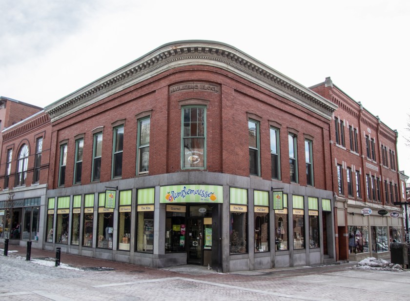
The interesting thing about The Point, besides its history and the street art that is scattered throughout the neighborhood, is that is a mere half a mile (give or take) south of the bustling Essex Street and other commercial areas of Salem.

Located off Congress St, The Point encompasses mostly Peabody and Ward Streets.  It is a short walk or drive from the intersection of Congress and Hawthorne streets.  One landmark to look for is Shetland Industrial Park.  You can easily spot the area of Congress St by the murals that are visible from the street.

But, The Point area wasn’t always known for street art.  Once the main area for fish drying along the peninsula, The Point was the center for Salem’s early maritime business and played a critical role in the economic development of the area.  These wooden fish drying “stages” gave the area its original name of Stage Point. Once the peninsula was filled in, the mostly French-Canadian mill workers adopted the name “La Pointe” for the area.

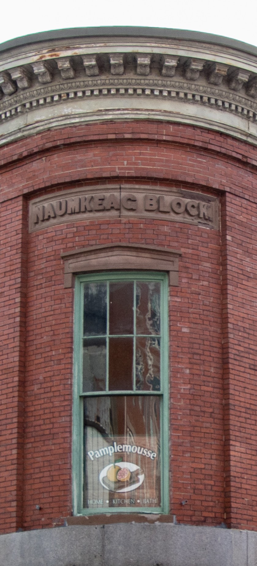
The Point would later become a hub for leather and shoe workshops in the early 19th century, The Point utilized its proximity to the harbor to take in imports such as coal and cotton.  One of the chief companies in this trade was a company founded by several Salem merchants called the Naumkeag Steam Cotton Company (there’s that name again – see previous Facebook post if you’re scratching your head right now).

As the area attracted more and more immigrant workers to the growing industries, boarding houses and company owned tenements (with modest rents I’m sure) were built to accommodate the growing population.

Sadly, the area would be destroyed by the “Great Fire of 1914” which destroyed 1,376 buildings and made over 18,000 people homeless or jobless.  Naumkeag Steam Cotton Company remained there, though.  At least until a wildcat strike in 1933 which highlighted the tensions between management and the workers.

Eventually, the Naumkeag business began to move their production to South Carolina in the 1940s and the company closed in 1953.  I’ve always found it interesting how the demographics of the various areas in New England (and the country) shift with the changing business landscapes.  As the Naumkeag company began to close mills, the French-Canadian people began to migrate.  In their place, new immigrants, chiefly from Puerto Rico and the Dominican Republic.  This diverse community exists largely in the area.  The name of the area changed yet again to “El Punto.”

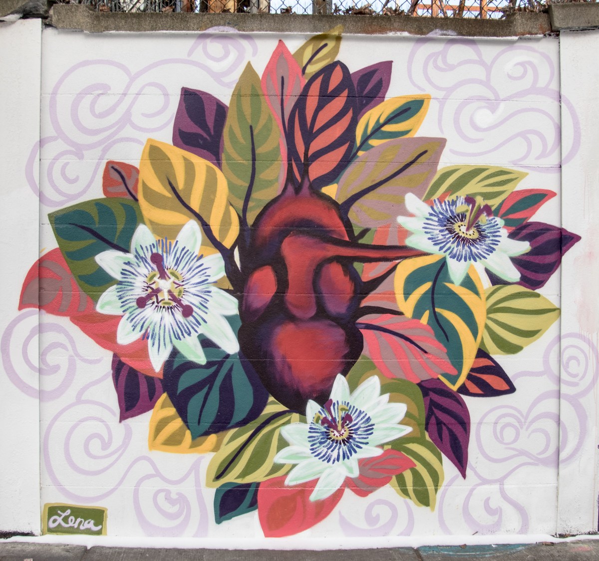
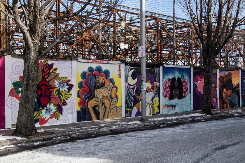
Murals and street art are spread throughout the “El Punto” area.  One of the first works of art you may notice is this mural on the side of a business.

IMG_3957

From the Congress St entrance to The Point, there are two streets.  Most of the art is on these two streets.  On Peabody Street there is a series of works of art along a fence created by artists in the area.  Unfortunately, the shadows were a little tough to work around and I was working on a tight schedule so I wouldn’t wait for better light.  This is a prime example of why mid day light is one of the worst times to photograph, although it is a common time for people to go out and photograph because you can’t always shoot during the blue or golden hours.  So, you work around the elements.  Luckily, I did have some cloud cover for some of the shoot which helped.  Also, the streets are very busy with traffic, so do take care if you go and parking is tight on this street.  I love how many of the murals look like art you might see in a museum or in a book.

I had to take some of the photos from unusual angles due to the parked cars on the streets and because of the areas where some of the murals were located.  For instance, this work of art of a woman with a chicken was located at the corner of a building which didn’t have a wide enough walkway to photograph from.  There were actually many murals on the buildings on Peabody and Ward streets.

IMG_3872-2

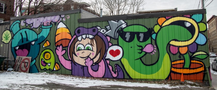
There were several spots on the buildings like this.

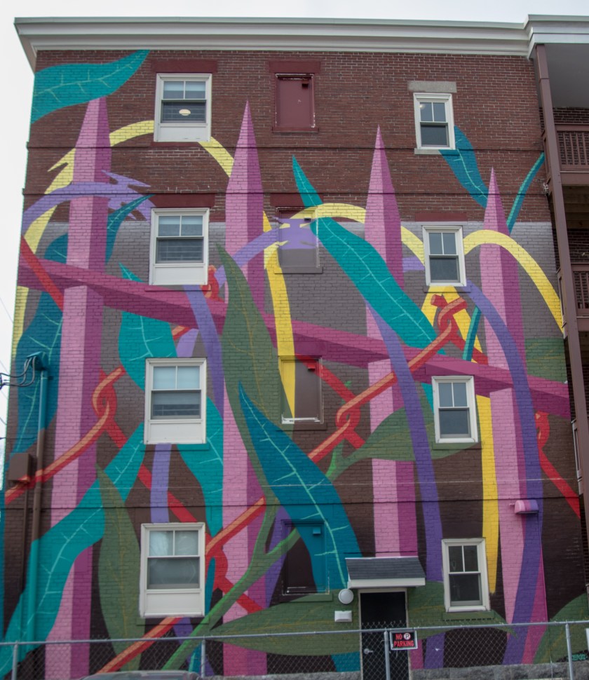
These murals on the apartment buildings in the aea and businesses were easier to photograph from the street.  I especially like the art that has a three dimensional feel to them.

The murals are not just on Peabody and Ward streets though.  In fact, you have to hunt for a few of the street art (some of which may technically not be in The Point area).

These works of art were located in an alleyway off Lafayette St.  There were lights strung up between the buildings in this alley.  I can only imagine they look even prettier, and are more fun to photograph, during the evening hours.  Mental note, come back for some evening photography another time.

And this lone mural was located on an unnamed (or at least there wasn’t a sign for the street) adjacent to Ward St.  Sometimes I wonder how annoying it must be for people who live in these buildings or in the area to have people stop by to take photographs.  But, I will also mention how on my many excursions to this area I have never been bothered.  People are both friendly and, I assume, used to seeing people in their neighborhood taking photos.  Naturally, I do try to be respectful and not spend too much time taking shots.  Despite the good nature of the people there I can’t help but feel like an intruder of sorts.

IMG_3970

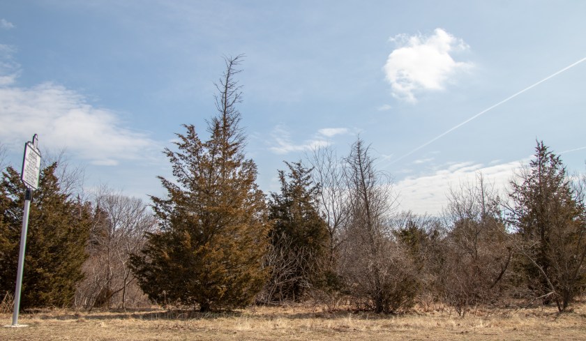
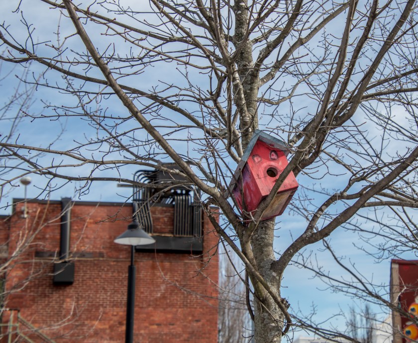
The Point is not just a place for art, though.  There is also a park at The Point, logically called Peabody Street Park (15 Peabody Street).  The park has trees, benches, a jungle gym and some pretty views from the Salem Harbor Walk.

There are also ceramic works of art from that appear to have been made by children that line the walls in the park.

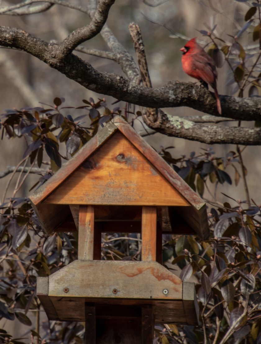
Birdhouses are placed in some of the trees at the park.

IMG_3908

There is also a mural from the downtown Salem area across the river which is visible from the Salem Harbor Walk.

IMG_3899

This mural is on a business located on Derby St not far from the Point.  It shows just how close the busy tourist area is to the largely unnoticed Point area.

With its beautiful works of art, pretty views and charm, The Point is definitely one of New England’s hidden gems.

Similar Places I Have Visited:

Cat Alley (Manchester, NH)

Please check out my Hidden New England Facebook page and like my page to see posts about Hidden New England which are not included in this blog.


Hidden History – Naumkeag (Salem, MA)

Date Of Visit: February 2, 2019

Location: Salem, MA (formerly Naumkeag)

Summary: The area now known as Salem, MA, was once known for so much more than the venue of the witch hysteria.

Although much is made of the Salem witch trials, there is much more to Salem’s history than this dark spot on the city’s past.

Long before Roger Conant settled in what is now Salem, MA, in the 1620s, the Naumkeag tribe had settled in what is now considered Essex County, comprising essentially the northeast corner of MA.  Although the area originally kept the name Naumkeag, the settlers would decide to change the name.  Naumkeag would eventually become known by its current name of Salem, a name derived from the Hebrew word for peace.

What is interesting is Salem is not the only area which bears the name Naumkeag.  Some areas of western Massachusetts, specifically an estate in Stockbridge bears this name.  If it is named after the same tribe that would be quite a distance to travel (well over 100 miles).  It’s not clear if the same tribe once lived there.  But, it’s more likely the name was derived from the Algonkian name for “fish” which I will touch on later in this post.

Salem keeps ties to the Naumkeag name with some businesses bearing the name and this building on Essex St that some people may never have noticed also bears the name of the area.  Most prominently, the building houses the liquor store Pamplemousse (185 Essex St) in addition to other shops.

IMG_3639

The name is not listed prominently.  So it could be easy to miss.  But, if you look up you can’t miss it.

IMG_3636

The name Naumkeag is most likely derived from the Algonkian root “Namas” meaning “fish.”  As the waterways of Salem were once plentiful with fish and fish was such a major food source this is a logical conclusion. In fact, after a quick search of restaurants in Salem it is evident it still relies on fish and other seafood for its economy.

The native Naumkeag was settled some 4,000 years ago as a seasonal fishing settlement.  Eventually, it became part of  a colonial settlement, as was the case with many former Native American settlements.  Roger Conant would settle that area and a much larger area in 1629.  Now, it is a mere footprint on a city which is rich in many aspects of American history.  In fact, it is plausible to write more hidden histories on Salem as it has played an essential role in many historical events other than the witch trials.  And it all started in a place called Naumkeag.

So, the next time you’re shopping on Essex St or photographing the Halloween revelers, take a look up and note that you’re actually at Naumkeag Block.


To receive updates when I post on this page and view other content I do not post on this page please consider liking my Facebook page at the following link: Hidden New England

Herb Mackey’s Metal Sculpture Yard (Salem, MA)

Date Of Visit: February 2, 2019

Location: 10 Blaney St, Salem, MA

Hours: The garden is able to be viewed any day at any time

Cost: Free

Parking: There is parking located at the Salem Wharf (just punch in the address above) and there is street parking available nearby

Handicapped Accessible: Yes

Dog Friendly: Yes

Summary: A metal garden of sculptures, figures and other objects located at a home in Salem, MA.

IMG_3562

While there are many gardens in Salem. MA, the Herb Mackey Sculpture Garden located by the Salem Wharf is unlike any other garden you’ve ever seen.

You won’t find roses, tulips or daisies at this garden.  But, the garden is environmentally friendly.  Mackey makes all of his sculptures from recycled and reused materials.

If you’re lucky to show up when there people outside working you may get a tour of the garden.  I arrived too early for any tour.  And, if you do see Herb Mackey or any of his other workers during your visit you may be able to take a metal souvenir home, for a small fee.

Mackey doesn’t consider himself an “artist” though.  He is just having fun and his works are just a hobby.  A fun hobby at that.  You may not see his work in the local Peabody Essex Museum.  But, if you do make a detour from the commercially successful downtown area and make your way to Mackey’s Metal Garden you may see some more interesting art than you would at any museum.